MercoPress. South Atlantic News Agency


Antarctica sea ice thicker than anticipated reveals an autonomous sub
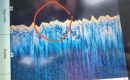
A novel autonomous sub has acquired the first detailed, high-resolution 3D maps of Antarctic sea ice. Released from a ship, the vehicle crisscrossed the underside of the floes, using upward-looking sonar to measure their shape. Read full article

Comments
Disclaimer & comment rules“the sharp decline seen in the Arctic.”
Nov 27th, 2014 - 09:21 am - Link - Report abuse 0This is a false picture of the Arctic, because it applies only to satellite measurements from 1979. Prior to that there was a period of exceptionally extensive ice in the 60's and 70's. In the early part of last century, there was far more open water than now and Amundsen negoiated the NW passage in 1906.
Of course that doesn't fit the global warming narrative so they don't talk about it.
I would have thought the thickness would have been self evident...what is it? 10% above...90% below or something like that....
Nov 27th, 2014 - 10:24 am - Link - Report abuse 0Just wait until KFC and her cronies find that this submersible is really a nuclear penguin mother ship...
Depends on a number of variables: the salinity of the water and the ice, the ambient temperature (to a degree), the shape of the ice and so forth, but the 90/10 split holds up reasonably well. However knowing that it holds up reasonably well isn't as good as actually measuring it.
Nov 27th, 2014 - 11:12 am - Link - Report abuse 0I for one am expecting KFC and her band of merry halfwits to accuse the UK of autonomously submarinizing the South Atlantic. It's obviously not a cunningly disguised British spy vessel - they're painted red (it's traditionally the air-sea rescue Attack Helicopters that are yellow).
Oh, dear, not going too well for the “frighten them with bollocks brigade” aka global warming / climate change (take your pick – another name will be along soon) is it?
Nov 27th, 2014 - 11:19 am - Link - Report abuse 0When actual measurements are obtained they are greater than satellite results!
WHY is this? The mathematical “corrections” that are “taken into account” are wrong? Surely not (don’t mention Shirley).
It’s farcical that the global bollocks “scientists” STILL cling to their over-extended “results” but not surprising. Without the grants from the deadheads at NASA how will they earn a living?
They can’t even trust the planet to do the “right” thing: the ozone hole is somewhat different, the ice has WARM water under it making it “thinner” all over, but now it ISN’T thinner after all.
I have always said that the puny humans can make a difference to the planet but it is about time the “it’s going up like a hockey stick” was dropped and the stick used across the heads of the doomsayers.
Still the more bullshit they give, the more millions the likes of Cameron will give to none existent climate rubbish.
Nov 27th, 2014 - 12:23 pm - Link - Report abuse 0The UK leads again! Note to argieland. That's British ice. Get it? Now we can get you from below. Nowhere is 'safe' for you.
Nov 27th, 2014 - 02:50 pm - Link - Report abuse 0Commenting for this story is now closed.
If you have a Facebook account, become a fan and comment on our Facebook Page!