MercoPress. South Atlantic News Agency
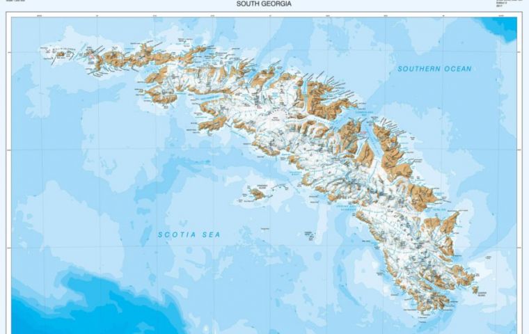
New map of South Georgia by British Antarctic Survey unveiled
 The sub-Antarctic island of South Georgia is a haven for wildlife, a centre for wildlife and fisheries research and famous for the epic voyage by Sir Ernest Shackleton and his men.
 A team of cartographers at British Antarctic Survey (BAS) has re-produced a high-resolution updated map of the sub-Antarctic island of South Georgia. The island, situated at 37°W 54°10’S is a haven for wildlife, a centre for wildlife and fisheries research and famous for the epic voyage by Sir Ernest Shackleton and his men just over a century ago.
Last updated in 2004, the map has new features including new bays and lakes created by recent glacier retreat. An interesting addition is a detailed map of the Shackleton Crossing, which is popular for mountaineers wishing to follow in the path of the great explorer’s 1916 expedition. This was produced in collaboration with the expedition and advisory panel at the Government of South Georgia and South Sandwich Islands (GSGSSI), who frequently advise visitors on routes across the island.
BAS has an in-house mapping team which is responsible for producing paper and web maps of the polar regions for the UK, and works closely with UK researchers to provide detailed maps for field work. The South Georgia map is produced at a 1:200 000 scale.
The Shackleton Crossing (1:40 000) includes three higher resolution maps, including the more dangerous parts of the crossing, including The Razorback and Breakwind Gap, which have near-vertical descents, which the Shackleton trio Shackleton, Tom Crean and Frank Worsley slid down by tobogganing on their coiled ropes.
Head of the Mapping and Geographic Information Centre at BAS, Dr Adrian Fox says: “We are really pleased with our new map of South Georgia, which will appeal to mountaineers and tourists visiting the island. It’s important to frequently update maps of this region as the environment is changing. For instance, on the north side of the island there is the newly formed Twitcher Bay, formed due to the retreat of Twitcher Glacier of over 4 km since the last edition of the map, and the extension of Cumberland West Bay by more than 6 km due to the retreat of Neumayer Glacier.”
The South Georgia and The Shackleton Crossing map is available for sale at several outlets including Stanfords map store in London (www.stanfords.co.uk, email: sales@stanfords.co.uk), the UK Antarctic Heritage Trust (www.ukaht.org/shop, email: sales@ukaht.org) and the post office on South Georgia. In addition, much of the map data is freely available to download from the South Georgia GIS and can be found here: www.sggis.gov.gs
This portal is the place to view, query and download South Georgia-related data and was built at BAS using open-source software. Version 3 was released in spring 2017 and includes substantially updated topographic data, as well as the location of visitor sites and wildlife colonies. (BAS)
https://www.bas.ac.uk/media-post/new-map-of-south-georgia-unveiled/


Top Comments
Disclaimer & comment rules-

Read all commentsEngland will return the Malvinas within 25 years.
Oct 15th, 2017 - 03:46 am 0Commenting for this story is now closed.
If you have a Facebook account, become a fan and comment on our Facebook Page!