MercoPress. South Atlantic News Agency


Ten-year input for the Atlas of the Patagonian marine ecosystem
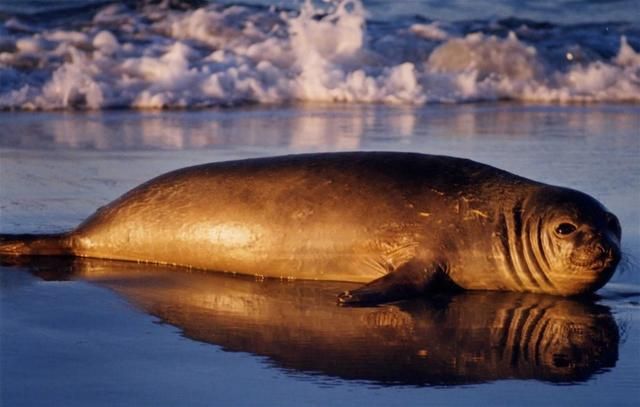 Southern sea lions were fitted with GPS collars to help provide data for the new atlas. (Photo: FITB)
 The Wildlife Conservation Society (WCS) and BirdLife International have released the first-ever comprehensive atlas of the Patagonian Sea -- a globally important but poorly understood South American marine ecosystem.
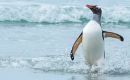
The atlas is based on hundreds of thousands of recordings of individual uplinks from satellite transmitters fitted on penguins, albatrosses, sea lions and other marine animals.
The atlas contains the most accurate maps ever assembled for this ecosystem, revealing key migratory corridors that span coastlines to deep-sea feeding areas off the continental shelf, hundreds of miles away.
Data for the atlas was gathered by a team of 25 scientists working over a 10-year period -- many of them supported by the National Research Council of Argentina (CONICET).
The team tracked 16 species of marine animals, which produced some 280,000 individual uplinks of data over the Patagonian Sea, a huge area ranging from southern Brazil to southern Chile.
'The Patagonian Sea is a remarkable intersection of global physics, marine biodiversity, and climate and economic change,' said Steven E. Sanderson, president and chief executive officer of WCS.
Many of the species tracked travel vast distances between coastal breeding grounds and feeding areas.
For example, satellite data revealed that southern elephant seals travel more than 10,000 km during an average season at sea, and an additional 10,000 km in repeated vertical dives for food.
'This unprecedented atlas was essentially written by the wildlife that live in the Patagonian Sea,' said Claudio Campagna, who runs the WCS's 'Sea and Sky' initiative.
'The atlas helps fill in many gaps of knowledge and should serve as a blueprint for future conservation efforts in this region,' Campagna added.
'This is an exceptional collaborative achievement; now that we know where some of the region's most important marine areas are, they need to receive appropriate protection and management,' said John Croxall, chairman of BirdLife's Global Seabird Programme.
The atlas, in English and Spanish, will be used to help inform potential policy decisions in the region such as managing fisheries and charting transportation routes of oil tankers.
This vast region, which spans three million square km, is becoming increasingly threatened by burgeoning development and over-fishing, said a WCS release.
Called Atlas of the Patagonian Sea: Species and Spaces, the 300-page book was edited by Valeria Falabella and Claudio Campagna of the WCS and John Croxall of Birdlife International.

Top Comments
Disclaimer & comment rules-

Read all commentsEcosistem can´t sustain 2 fishing fleet and a third piratical fishing fleet.
Nov 20th, 2009 - 10:24 am 0Stop calling foreign fleets.
Be respectfull of life. You are 2500, but you destroy south atlantic ecosistem for 100 millon people.
South Atlantic must be preserved; now we are in the wrong way; the best situation for enviroment should be a combined fleet fishing for 40+20 millon people every year. We need sustainabilty in south atlantic; stop calling foreign fleets, only locals.
Commenting for this story is now closed.
If you have a Facebook account, become a fan and comment on our Facebook Page!