MercoPress. South Atlantic News Agency

FAO provides satellite high-resolution data to combat deforestation
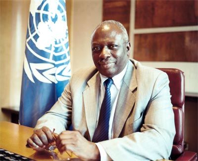 Director General Jacques Diouf made the announcement
 The UN Food and Agriculture organization, FAO, and other partners have made available a worldwide, free and ready-to-use high-resolution satellite data with the purpose of monitoring forests and help reduce emissions from deforestation and forest degradation.
“The Global Forest Resources Assessment brings a revolution to the forest monitoring field. Never before have data of this kind been provided directly to users in developing countries. Monitoring will be cheaper, more accurate and transparent for countries that want to participate in reducing emissions from deforestation and forest degradation,” said FAO Director General Jacques Diouf.
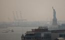
The world's forests are in the spotlight as talks for a new climate change deal move towards an agreement on how to achieve reduced emissions from forests next December in Copenhagen, Denmark.
A mechanism for Reducing Emissions from Deforestation and Forest Degradation (REDD) would be a breakthrough in the fight against climate change and represents one of the areas where most progress is expected in Copenhagen.
It is the first time that a global forest scheme has the potential to generate such a magnitude of benefits for developing countries. Diouf underlined how a REDD mechanism would not only bring a reduced impact on climate but also much needed resources to improve livelihoods, conservation efforts and food security.
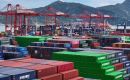
At the same time, many issues remain to be solved before REDD will work. One of the corner stones is Measurement, Reporting and Verification systems of carbon, which must be in place for carbon accounting and payments to be carried out in an appropriate and transparent way. Today, the majority of developing countries do not have sufficient monitoring systems in place.
Satellite remote sensing has provided images of the Earth for over 30 years. The technology and associated science has vastly improved the knowledge and perception of our planet.
“The FAO Forest Resource Assessment is unprecedented in so many ways. It is the most comprehensive and challenging use of high resolution satellite data ever attempted and the use of the historical time-series of Landsat images will result in sound and objective estimates of global forest and land cover change.” says Jeffrey Eidenshink, Acting Director of the U.S. Geological Survey Earth Resources Observation and Science (EROS) Center. Other partners include South Dakota State University, U.S. and the European Union Joint Research Center.
The monitoring system delivers data in a global sample grid at 13 000 locations and provides tools for their interpretation. It is designed to improve global and regional information on forest change in FAO's assessments of forests.
For a country the sample grid can be intensified and become a cost-efficient approach to measure national forest trends.
“This system will not cover all information needs for REDD, but the remote sensing approach, together with field verification, will provide forest area changes in a robust and verifiable way - a crucial component for carbon accounting under REDD,” said Mette Wilkie who coordinates the Global Forest Resources Assessment Programme at FAO.
The UN-REDD Program, a collaborative partnership between FAO, UNDP and UNEP supports developing countries to prepare for REDD.

Top Comments
Disclaimer & comment rulesCommenting for this story is now closed.
If you have a Facebook account, become a fan and comment on our Facebook Page!