MercoPress. South Atlantic News Agency
Satellite mapping show Chilean cities hit by quake have “grown” in height
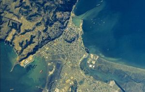
 Talcahuano is estimated to have risen by 1.5 meters
 Chilean scientists working next to US Geological Service (USGC) peers are mapping areas of the country devastated by the February 27 earthquake to determine how much has changed geographically.
Primary information shows that some of the cities hardest hit have grown in height: Concepción 1.2 meters and Talcahuano, 1.5 meters.
Juan Carlos de la Llera, engineer from the Universidad Católica engineer, says there are two points where the Feb. 27 earthquake released its energy. According to de la Llera satellite images supplied by the USGC show that the quake started in Cobquecura and continued north, where it hit another zone with a lot of accumulated seismic energy which caused another seismic wave.
The technique for mapping the earthquake and its energy points has been used before, but de la Llera says “it has never been mapped out so clearly.”
The reason why the energy wave went north is that there was barely any seismic energy south of Cobquecura, theorized de la Llera because Chile’s 1960 earthquake released so much energy that very little was accumulated there on February 27.
De la Llera working with the USGC is making another map of the affected area to find out how Chile changed geographically after the earthquake. It will also be used to measure the location of the energy focus points with high precision. “It is possible we will find a third energy point,” he said.
Satellite photos taken before and after the earthquake show how much the earth has sunk or risen. Lebu, for example, South of Concepción, was raised by three meters, Concepción raised by 1.2 meters and the port of Talcahuano, 1.5 meters.
De la Llera says one would expect the cities closest to the epicenter (Cobquecura) to have gone up the most. But data shows otherwise. “It is a complicated phenomenon. Local geological conditions can change the effect of the seismic waves,” he says
By Loretta van der Horst – Santiago Times


Top Comments
Disclaimer & comment rulesCommenting for this story is now closed.
If you have a Facebook account, become a fan and comment on our Facebook Page!