MercoPress. South Atlantic News Agency


RRS James Clark Ross sails to Falklands collecting Mid-Atlantic Ridge data
 As the ship slowly navigates its way following the contour of the Mid-Atlantic Ridge, data is being continually collected
 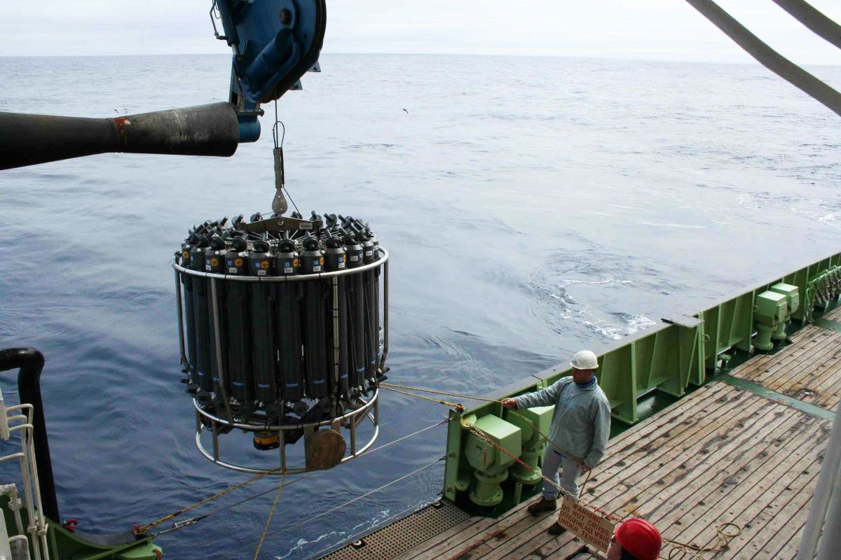 RRS James Clark Ross is stopping at each open ocean station and deploying CTD (Conductivity, Temperature and Density device) to measure water key properties
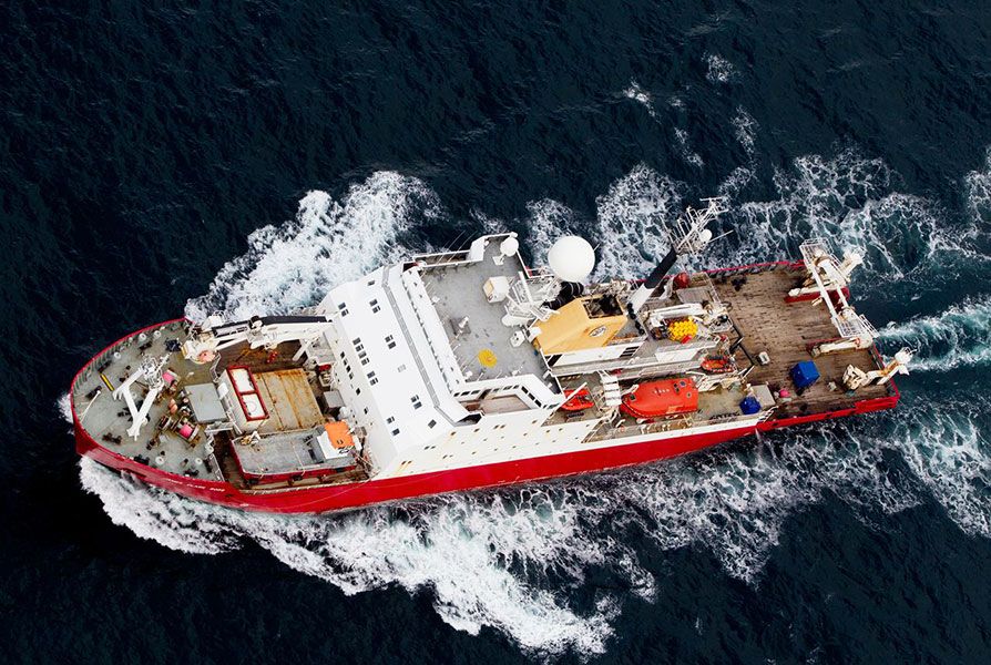
 British Antarctic Survey ship, the RRS James Clark Ross, set sail on its long voyage from Immingham in the UK to Stanley in the Falkland Islands last 20 September. The ship, which carries out important scientific research in the Southern Ocean during the Antarctic summer months, is conducting survey work as it makes its passage south.
On board is a group of scientists from the Plymouth Marine Laboratory, the University of Southampton and the French Research Institute for Exploration of the Sea (IFREMER). As the ship slowly navigates its way through the Atlantic Ocean, following the contour of the Mid-Atlantic Ridge, data is being continually collected to assess the biological, physical and chemical properties of the ocean.
The information will be used to verify the data collected from satellites orbiting the Earth. These data provide a global overview of oceanic conditions, which enhances our understanding of what’s happening in the global climate. They are vitally important as they cover vast areas of the ocean that are usually difficult to access.
The new European Space Agency satellites, the Sentinels, are a suite of missions financed by the European Commission Copernicus programme, to monitor the planet. These satellites carry an array of sensors for observing land, ocean and atmosphere.
The scientists have mounted visible and infrared radiometers and radar systems on the ship to acquire continuous fiducial reference measurements to validate the new satellites.
As the James Clark Ross stops at each open ocean station a CTD (Conductivity, Temperature and Density device) is deployed to measure key properties in the water column. These measurements help determine levels of water temperature and salinity at different depths. During this particular research cruise, between 100 and 120 CTD casts will be conducted.
You can follow the cruise’s progress on this European Space Agency hosted blog.

Top Comments
Disclaimer & comment rules-

-

-

Read all comments@2
Oct 01st, 2016 - 09:21 am +1If we don't do it, you will HaHaHa you crack me up. Actually as can be seen in the picture the UK is deploying remote controlled nuclear devices so that you cannot attack the FALKLANDS in the future. By the way you talk a load of bollocks.
I see those nasty brits are scientifically invading the south Atlantic again...lol
Sep 30th, 2016 - 07:12 pm 0So the argies will say.
A lot of RGs do talk bollocks, especially about their precious “rights” in the South Atlantic.
Oct 01st, 2016 - 11:32 am 0Commenting for this story is now closed.
If you have a Facebook account, become a fan and comment on our Facebook Page!