MercoPress. South Atlantic News Agency


Parts of Uruguay on brink of agricultural emergency due to poor rains
 Mattos also said the outlook in terms of rainfall for the coming months “is not encouraging”
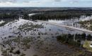
 Uruguay's Livestock, Agriculture, and Fisheries Minister Fernando Mattos has not ruled out declaring a national emergency due to the water deficit caused by poor rains, despite western and southern parts of the country being the most severely affected by the lack of rainfall during the winter.
Mattos explained there was “a complex situation in terms of winter crops, which were installed with very high prices due to their very high costs based on the value of fertilizers, fuels, and grains, which were very expensive.”
“Unfortunately, this required very high productivity levels in order to level the economic equation,” he added.
“It has rained practically nothing in the last months” so the grain-filling situation is “critical,” he also pointed out. “We will probably have a significant output loss and we will see what solutions we can find for this situation,” he further underlined.
Mattos also said the outlook in terms of rainfall for the coming months “is not encouraging.”
“Surely by the end of the month, if there is no reversal of this situation, we would have to declare some areas in a situation of agricultural emergency,” he went on.
Agreeing with Mattos earlier this month was leading Uruguayan meteorologist Mario Bidegain, who forecast this Spring would the third in a row with a rainfall deficit, something unseen for the previous 20 years.
“It's not going to be all over the country, but it is going to be in some areas of the eastern part of the country and even the south, where they may be needing the rain the most,” Bidegain had said.
“This means that it has rained only 20% of the normal rainfall in September in the South of the Negro River, this could be of great help to recover some of the moisture in the soils that have been lost week after week”, he added.
“Unfortunately we continue with the influence of La Niña, with the cooling of the Pacific Ocean, this has already been affecting us not only this month but this is the third year that we come with a cold phase, it is an episode that was not seen for more than 20 years of three consecutive springs with a precipitation deficit caused by La Niña,” the expert also pointed out.
“Spring is going to be dry in most of the country due to the effect of this climate variability,” he stressed, although he did anticipate rainfalls for Thursday and Friday this week. He was cautious, however, as to the intensity and geographical distribution of the precipitations at a time when crops and pastures are highly affected by the accumulated water deficit.
Bidegain a professor in meteorology and a private consultant specializing in climate, a former director of the Climatology Area of the current National Institute of Meteorology (Inumet) also announced that the rest of October and November will be mostly dry.
Uruguay's Institute of Meteorology (Inumet) also released a report last month noting that between June and August “the highest accumulated precipitation occurred in the northeast and central-east of the country, while the lowest accumulated took place in the south and south-west” and that ”the range of precipitation was between 514.0 mm in the locality of Centurión (Cerro Largo) and 70.2 mm in the locality of El Cerro (Colonia).”
”Regarding rainfall anomalies, the southwestern and central regions of the country are the ones that presented the most important deficits,“ the report added.

Top Comments
Disclaimer & comment rulesCommenting for this story is now closed.
If you have a Facebook account, become a fan and comment on our Facebook Page!