MercoPress. South Atlantic News Agency


Uruguay braces for heavy storm
 “Inumet has decided to raise the current alert level from orange to red,” Santayana announced
 Classes were suspended in Uruguay for Thursday and other precautions were taken after a red alert was declared following the Weather Bureau's forecast of heavy electrical storms. Such a measure is enacted “when the intensity of a meteorological phenomenon in course or forecast implies an extreme or imminent risk level for the population in general.”
The National Administration of Public Education (ANEP) therefore suspended all classes in the departments (provinces) where the bad weather was expected: Canelones, Colonia, Durazno, Flores, Florida, Lavalleja, Paysandú, Río Negro, San José, Soriano, Tacuarembó, and Treinta y Tres. However, the red alert was extended to the whole country later Wednesday at least until 5 am Thursday given the Uruguayan Institute of Meteorology (Inumet) projections.
In this scenario, all government agencies were instructed to “suspend all activities associated with the risk” except for those stemming from “essential activities of the State.”
“The different areas of private activity are urged to comply with the above provisions, by adopting measures following the criteria set forth,” the Uruguayan government also decreed while the population was urged to follow the recommendations issued by the National Emergency System (Sinae).
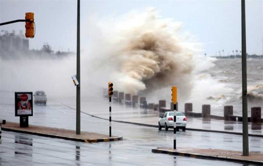
Inumet Director Néstor Santayana spoke of ”strong wind gusts, greater than 90 km per hour, hail fall (greater than 2 cm), intense electrical activity and heavy rainfall.“
”Inumet has decided to raise the current alert level from orange to red for the southwest and center of the national territory,“ he also said
”The most intense phenomena that we are forecasting for the rest of today and early morning will move from southwest and south to the north. Later it will begin to improve because it will change the air mass and what we expect for the coastal strip, south and east from 21, 22 hours is the increase of the wind from a southeast component which will lower the temperature, which ends this string of more than ten days of rainfall and storms,“ he also pointed out.
”This red alert in itself not only considers meteorological factors but also what has been happening in the country, that is to say, hydrological factors because we have a totally saturated soil in practically all the national territory,“ he went on.
”As for the rainfall of the last hours, what is going to happen is that it will precisely generate that surface runoff so that the soil will no longer absorb. It should be noted that these severe storms may also produce intense electric activity, very strong wind gusts that will exceed 90, 100, 130 kilometers per hour, that is why the red alert has been issued in different localities,” he elaborated.

Top Comments
Disclaimer & comment rulesCommenting for this story is now closed.
If you have a Facebook account, become a fan and comment on our Facebook Page!