MercoPress. South Atlantic News Agency
La Niña projected to take its toll in the Southern Cone
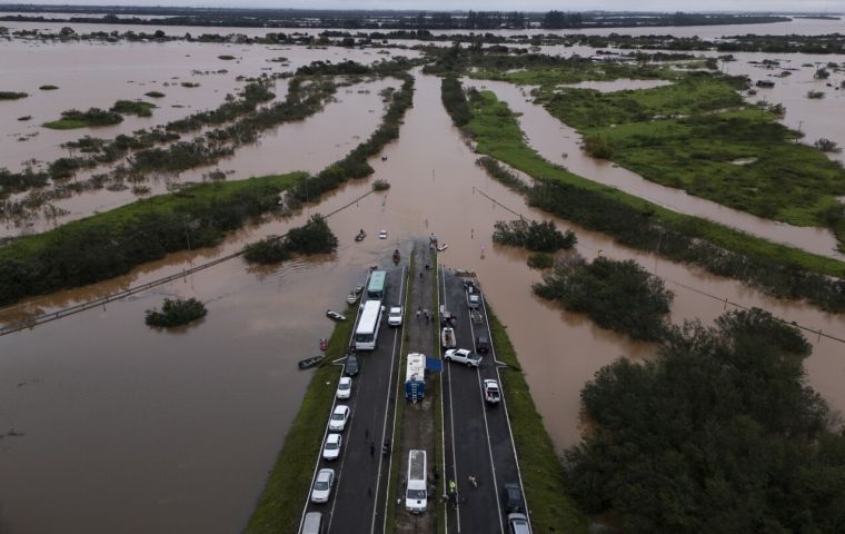
 La Niña is feared to cause considerable economic losses, mostly regarding agricultural outputs due to droughts but also considerable damage from excessive flooding. Photo: EFE/ Isaac Fontana
 Meteorologists foresee that the La Niña weather phenomenon will not go unnoticed in the Southern Cone next year after the Brazilian agency Metsul reported signs of unusual activity in the Pacific Ocean. The main impact will be reflected in mercurial temperatures, MetSul's warning noted.
“Although atmospheric conditions were already showing signs of La Niña, sea surface temperature anomalies were not yet consistent with the phenomenon,” the Brazilian observatory mentioned.
According to MetSul, La Niña is at an early stage and is not expected to last long, unlike in 2023 when it was more intense. This time around, it might span three to five months, the projected climate models showed. La Niña usually includes a decrease in precipitation and an increase in temperatures. However, during next year's version “the waters of the central and eastern equatorial Pacific Ocean become colder than normal” which “has significant effects on wind, precipitation and temperature patterns around the world,” MetSul noted.
Historically, La Niña has been associated with droughts and adverse weather conditions, which has generated concern, particularly in southern Brazil and neighboring countries such as Uruguay, Argentina, and Paraguay. The last prolonged La Niña event occurred between 2020 and 2023, causing droughts and a water crisis in these countries.
La Niña is forecast to be highly noticeable in mid-January. “We are in a La Niña warning episode. La Niña has been in place for a couple of months now. It has made the thermal bias that usually occurs in summer not as pronounced,” Nimbus Weather meteorologist Juan Luis Pérez explained.
The La Niña phenomenon is a phase of the climate cycle known as El Niño-Southern Oscillation (ENSO) with cooling waters in the equatorial Pacific Ocean recorded since the late 19th century, although it was not until recent years that experts had a more thorough understanding. La Niña tends to cause a variety of climatic impacts in different regions, including droughts in some parts and intense precipitation in others.
First described in the 1950s, La Niña has been behind significant climatic variations impacting agriculture and the economies of several countries, especially in South America, Asia, and Australia, with peak episodes in 1988-1989 (severe droughts in Brazil and Argentina), 1998-2001 (a significant cooling of the Pacific Ocean causing floods in Indonesia and droughts in eastern Australia), 2010-2012 (droughts in South America, heavy rains in Australia, and food shortages in Paraguay), and 2020-2022 (mercurial rainfall patterns in South America with heavy rains in some regions of Brazil and Uruguay and droughts in northeastern Argentina).
La Niña tends to occur irregularly every 2 to 7 years, and although not all occurrences are the same, the statistics regarding its effects are significant. It is estimated that about 40% of La Niña occurrences are associated with severe droughts in the Southern Cone region, mainly in Argentina, Uruguay, and Paraguay. As a result, countries that are dependent on agriculture have been severely affected in terms of output. Temperatures in areas affected by La Niña tend to be colder than normal, which can affect food production. Fluctuations in climate as a result of La Niña can cause considerable economic costs, affecting anything from crops to electricity generation.


Top Comments
Disclaimer & comment rulesCommenting for this story is now closed.
If you have a Facebook account, become a fan and comment on our Facebook Page!