MercoPress. South Atlantic News Agency


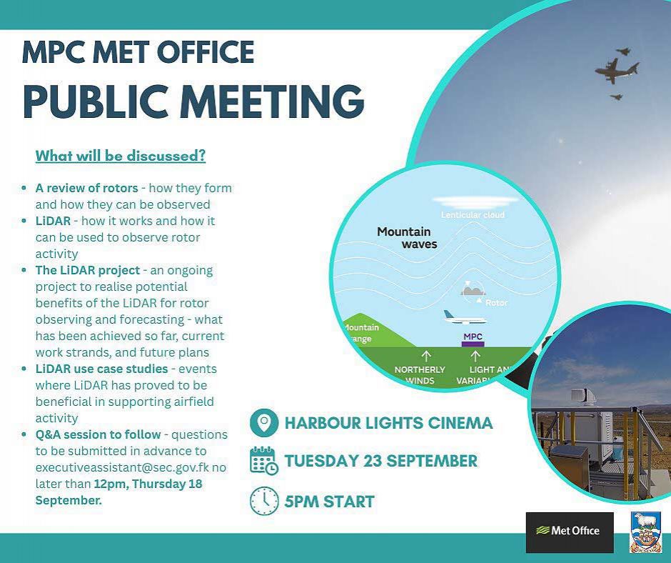
Falklands, MPC Met Office presentation on rotor activity and the LIDAR Project
 The LiDAR project, to realize potential benefits for rotor observing and forecasting – what has been achieved so far, current work strands, and future plans.
 Next Tuesday 23rd September at 5PM there will be a public meeting in the Harbor Lights Cinema where the Mount Pleasant Complex MPC Met Office will present a review of rotors, (*) how do they form, and how can they be observed.
LiDAR – how it works and how can it be used to observe rotor activity (**)
The LiDAR project – an ongoing project to realize potential benefits of the LIDAR for rotor observing and forecasting – what has been achieved so far, current work strands, and future plans.
LIDAR use case studies – events where the LiDAR has proved to be beneficial in supporting airfield activity.
This will be followed by a Q&A session.
(*) “Rotor winds” refer to localized areas of severe turbulence that occur on the leeward side (downwind side) of mountains or other high terrain due to the interaction of wind with topography. These high-amplitude, horizontal vortices, known as rotors cause air to circulate and roll like a “washing machine”. They are a significant hazard to aircraft, leading to severe changes in wind speed and direction and potential loss of control.
(**) In English, LiDAR is an acronym for Light Detection and Ranging and refers to a remote sensing technology that uses laser pulses to measure precise distances to an object, creating a detailed 3D map of the surrounding environment, known as a point cloud. It works by measuring the time it takes for a laser pulse to travel to an object and reflect back to the sensor.
Top Comments
Disclaimer & comment rulesCommenting for this story is now closed.
If you have a Facebook account, become a fan and comment on our Facebook Page!