MercoPress. South Atlantic News Agency

Uruguay prepares protocols for the risk of El Niño flooding in the spring
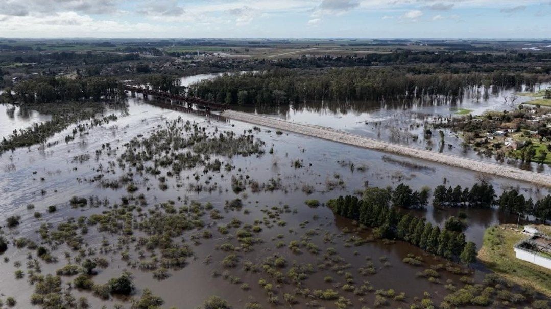 “The challenge we face now is preparing for what may happen in the spring as a result of this climate phenomenon,” the president said
 Uruguay's government is drawing up a set of contingency protocols for the flooding risk associated with the El Niño phenomenon, which climate projections indicate will have its greatest impact on the region during the southern hemisphere spring. President Yamandú Orsi announced at the Congress of Departmental Governors that the measures will be presented in August, ahead of what may occur from September and October.
“The challenge we face now is preparing for what may happen in the spring as a result of this climate phenomenon,” the president said. He indicated that the protocols drawn up by the departmental emergency coordination centers will be put on the table and that a coordination space will be created with the National Emergency System. “We have a record, going back to 1998, of how floods play out and we know where they will hit hardest and where less. It will not affect every area in the same way,” he added.
The available projections are probabilistic. NOAA's Climate Prediction Center puts the probability of El Niño conditions during the June-July-August quarter at close to 100%, persisting at least through the end of the year. Uruguay's Meteorological Institute does not forecast specific flooding, but projects a higher probability of above-normal rainfall in the country's northeast, with that signal expanding toward the north and part of the center during the spring. Brazilian consultancy MetSul estimates a probability above 80% that accumulated rainfall will substantially exceed historical averages in southern Brazil, northeastern Argentina, and across Uruguay, placing the period of greatest risk between September and December.
A central concern is the effect of rainfall in southern Brazil on the flow of the Uruguay River, which runs along the country's western edge. Rio Grande do Sul has already recorded flooding episodes this month. National Party senator Sebastián Da Silva said management of the binational Salto Grande dam will be decisive and warned about the situation of the Río Negro dams, while identifying the Merín Lagoon basin, the Estero de Pelotas, and the Treinta y Tres lowlands as sensitive areas. He called for machinery and shelter space for potential evacuees to be arranged in advance.
Meteorologist José Serra said the movement of moisture from the equator toward southeastern Brazil and Uruguay has already begun to affect dams in the country's north, and put forward, as his own hypothesis, that a convergence between El Niño and a cooling of North Atlantic waters could amplify the phenomenon's effects.
The region is already going through a season of extreme events. Last week, Chile declared a state of catastrophe in the north of the country over a storm that left at least ten dead.


Top Comments
Disclaimer & comment rulesCommenting for this story is now closed.
If you have a Facebook account, become a fan and comment on our Facebook Page!