MercoPress. South Atlantic News Agency
Squall hits Piriapolis - all of Uruguay under metheorological orange alert
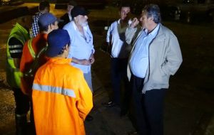
 Maldonado Mayor Enrique Antia taking action in the face of severely adverse weather
 From 6 am till Tuesday midnight, according to Inumet. Montevideo, Colonia and other key cities are code yellow. Some experts also speak of tornadoes.The Mayor of Maldonado, Enrique Antia, moved to Piriápolis to see first hand the consequences left by the squall that reached 180 kilometers per hour on Monday, and affected several parts of the city.
“The wind was irresistible. At the bus terminal ripped 300 meters of roof, some of the plates were four blocks, and luckily did not hurt anyone because they are galvanized sheets that flew meters and meters away,” he told a local newspaper. It is the third event linked to climate affecting the department.
The Uruguayan Institute of Meteorology (Inumet) Monday issued an orange warning for severe storms and heavy rainfall for the entire country from 6 am on Tuesday until midnight, with yellow risk levels for Montevideo, San José, Canelones, Florida, Flores, Colonia, Rocha, Maldonado, Lavalleja and Soriano.
Secondary School Director General Celsa Bridge reminded the public that if the warning is yellow or orange, schools remain open but attendance is controlled. Only under red alert do school centres close their doors.
According to Brazilian private forecast company MetSul a new extratropical cyclone affecting the south and east of Uruguay is to be expected. On Tuesday November 1 there will be “lots of rain and storms in several cities with volumes of 50 mm to 100 mm in a short period of time in some places and heavy storms with strong winds and localized hail,” while warned that “a new extratropical cyclone formed in eastern Argentina and will cause strong winds for several hours in the south and east of Uruguay with speed of 60 km / h to 80 km / h and higher gusts of 80 km / ha 100 km / h ” on November 2.
Meteorologist Guillermo Ramis said in an interview that ”there are conditions of instability high enough so that in a certain region (Rivera, Artigas, Salto, Paysandu and Rio Black) can produce a tornado“ and added that ”there are places (Soriano, Colonia, Flores, Florida, Treinta y Tres and Cerro Largo) that can be squalls and even some more severe situation.“
Regarding the possibilities of a tornado, meteorologist Diego Vazquez Melo said that those ”can only be predicted minutes in advance, and only if you have an operating Doppler radar in high resolution mode, dual polarization and with a range of 240 km,“ a kind of equipment which Uruguay lacks, but alternatively could use ”images generated by weather radars in Ezeiza and Pergamino, belonging to the National Weather Service of Argentina“.
Vazquez Melo predicts for November 1 a ”cooler, wet, cloudy, windy and very unstable day, with scattered (punctually severe) heavy storms and heavy rains. The general system or southwest winds will rotate and be intensified to strong with very strong gusts.”


Top Comments
Disclaimer & comment rulesCommenting for this story is now closed.
If you have a Facebook account, become a fan and comment on our Facebook Page!