MercoPress. South Atlantic News Agency


Millions of rivers and lakes to be surveyed by a Nasa satellite
 Swot is expected to help resolve all rivers at least 100m wide, and see all lakes larger than 6 hectares.
 NASA, the US space agency has launched a satellite that's expected to transform our view of water on Earth and further illustrate on climate change. The Swot, Surface Water and Ocean topography, the mission will map the precise height of rivers, reservoirs, and lakes, and track ocean surface features at unprecedented scales.
It should improve flood and drought forecasts, and help researchers better understand how the climate is changing. British scientists have been asked to help set up the spacecraft using the Bristol Channel as a benchmark.
The UK researchers are putting a suite of sensors in the estuary to “ground truth” the observations made by the satellite as it flies overhead at an altitude of 890km.
Lift-off for the Swot mission occurred from California. A Falcon rocket took it skyward at 03:46 local time (11:46 GMT). Swot is led principally by Nasa and Cnes, the French space agency, with contributions from the UK and Canadian space agencies.
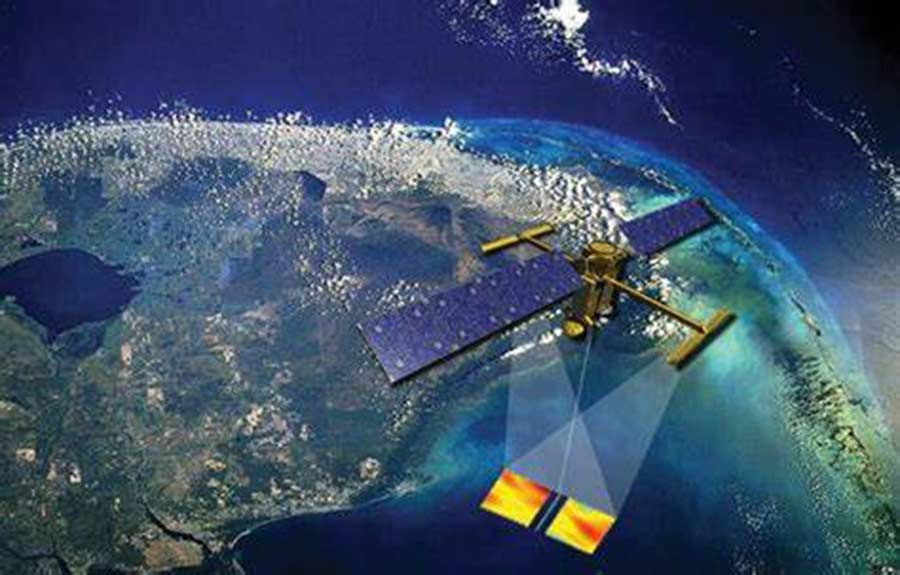
Anyhow it will be a few months before Swot comes fully into operation; its French-built Ka-band Radar Interferometer (KaRIn) has long booms that must be unpacked first.
Once in position, the instrument's antennas will begin pulsing the Earth's surface, counting the time that reflections take to come back to the spacecraft. It's these echoes that allow Swot to make very precise determinations of height.
Essentially, the satellite will be imaging water bodies, assessing their rise and fall in detail and across a very wide swath. Swot is expected to help resolve all rivers at least 100m wide, and see all lakes larger than 6 hectares.
“The amount of data from Swot on rivers and lakes will be orders of magnitude more than currently exists,” said Nasa project scientist Dr Lee-Lueng Fu.
“For instance, only 10s of 1,000s of lakes have been well surveyed. We'll be surveying millions of lakes.”
For the ocean, Swot will see the bulges and depressions in the water surface associated with currents and eddies as small as 20km across. It's the swirling of water in eddies that pulls heat and carbon dioxide out of the atmosphere, tempering the impact of global warming.
“The unprecedented information can also be used to improve our understanding of ocean circulation, and this then has the potential to yield important information for a wide range of industries like shipping, fishing, and even recreation,” explained Ben Hamlington, a Nasa sea-level scientist.
“We also know that small-scale features are responsible for transporting pollutants around the ocean and then to our coasts. Examples of this would be oil spills, or ocean debris following tsunamis.”
Britain has put US$ 15m into the mission, most of which was spent in UK industry.
Dr Beth Greenaway, the head of Earth observation at the UK Space Agency, attended the launch in California, “I am very proud to be representing the UK elements of the build - the part that provides the radar pulses through the instrument at never before seen frequencies. The UKSA's partnership with the French space agency, Cnes, enabled the engineers in Honeywell UK to build this complex duplexer.”
But the British involvement also extends to the coming “calibration and validation” campaign in the Spring, which will check Swot is returning good information.
This will involve putting sensors in the Bristol Channel to make comparable observations as the spacecraft goes overhead. The estuary was chosen because it experiences sweeping variations in water height. It has one of the largest tidal ranges in the world.
“Swot's going to give heights to within about 10cm. So, we've got to know the absolute elevation at ground level to a much higher accuracy,” said Bristol University's Prof Paul Bates, who'll lead the campaign.
“We've been going to tide gauges, sitting GPS stations on them, and then thinking about things like temperature, pressure, salinity - all those kinds of potential variables. And we'll end up with a network of very accurate water elevations around the estuary.”
Prof Bates thinks Swot should have the ability to see the famous bore that periodically runs up the channel into the lower reaches of the River Severn. He plans to use the satellite data to pursue his interest in flood modeling.

Top Comments
Disclaimer & comment rulesCommenting for this story is now closed.
If you have a Facebook account, become a fan and comment on our Facebook Page!