MercoPress. South Atlantic News Agency
Tag: NASA satellite
-
Tuesday, December 20th 2022 - 08:53 UTC
Millions of rivers and lakes to be surveyed by a Nasa satellite
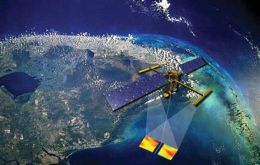
NASA, the US space agency has launched a satellite that's expected to transform our view of water on Earth and further illustrate on climate change. The Swot, Surface Water and Ocean topography, the mission will map the precise height of rivers, reservoirs, and lakes, and track ocean surface features at unprecedented scales.
-
Wednesday, January 31st 2018 - 09:29 UTC
NASA satellite keeps track of wildfires in Argentina
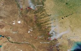
Roughly 12,000 wildfires burn each year in Argentina, charring more than 1.3 million hectares (5,000 square miles) of forest and grasslands. The Moderate Resolution Imaging Spectroradiometer (MODIS) on NASA’s Aqua satellite captured an image of one of them on January 29, 2018.