MercoPress. South Atlantic News Agency

Argentine Post uses interactive map mentioning Falklands and Stanley
 Among those most critical in this circumstance was former Malvinas Secretary Guillermo Carmona
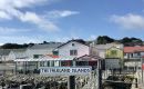
 Argentina's Postal Service took heavy flak for using an interactive map on its website, where the South Atlantic Islands Argentina claims to own were referred to as Falklands (and not Malvinas) and its capital was Stanley (not Puerto Argentino), which drew criticism from a several surfers who spotted the Government's slip.
The state-run agency claimed it was an “involuntary error linked to the external supplier of the cartographic service” (OpenStreetMap) via the Leaflet digital library. Following social media criticism and political outcry, the map was deactivated, and steps were initiated to correct it.
The Argentine Post then reaffirmed through a statement its commitment to Argentina's sovereignty claims over the archipelago. “In view of this, we immediately proceeded to deactivate the corresponding map and to initiate the necessary steps for its correction,” it said while thanking users for their understanding, while ratifying its adherence to a “responsible communication and respectful of national principles.”
Socialist lawmakers also took steps within the Lower House to have the issue corrected.
Among those most critical in this circumstance was former Malvinas Secretary Guillermo Carmona.
The controversy came just days after President Javier Milei was criticized for wanting the Falkland Islanders to want to belong to Argentina, which was regarded as acquiescing to the principle of self-determination Argentina does not recognize in its territorial dispute to a population deemed to be implanted by the usurping power.

Top Comments
Disclaimer & comment rules-

Read all comments“Public outcry” makes it sound remarkably tragic. Hardly anyone actually cares. Carmona, (the clue is in his name) would whine about it, but, let's face it, Argentina never had possession of the Falkland Islands (not even in '82!) and the capital has always been either Port Stanley or just Stanley.
Apr 23rd, 2025 - 11:53 am +7Commenting for this story is now closed.
If you have a Facebook account, become a fan and comment on our Facebook Page!