MercoPress. South Atlantic News Agency
Tag: Antartic Peninsula
-
Saturday, February 15th 2025 - 20:26 UTC
New map of South Orkney Islands published for the first time in 40 years by BAS
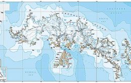
A new map of the South Orkney Islands has been released by British Antarctic Survey (BAS) – the first UK published, topographic map of the region in almost 40 years. Created by the Mapping and Geographic Information Centre at BAS, the map offers a detailed topographic view of the entire South Orkney archipelago on one side, with a focused, high-resolution map of Signy Island on the reverse.
-
Tuesday, August 16th 2016 - 21:44 UTC
Ocean warming primary cause of glacier retreat in the Antarctic Peninsula
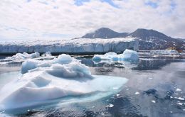
A new study has found for the first time that ocean warming is the primary cause of retreat of glaciers on the Antarctic Peninsula. The Peninsula is one of the largest current contributors to sea-level rise and this new finding will enable researchers to make better predictions of ice loss from this region.
-
Tuesday, May 3rd 2016 - 21:04 UTC
Antarctica visitors increase 4.6% in 2015/16; IAATO celebrates 25th anniversary
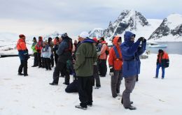
The International Association of Antarctica Tour Operators (IAATO) announced its tourism figures for the 2015-2016 Antarctic season on the first day of its 25th Anniversary Meeting in its home town of Newport, Rhode Island, USA.