MercoPress. South Atlantic News Agency
Poachers beware: new tech. monitoring Falklands waters

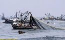
Developments in satellite and communications technology combined with new fisheries legislation have given the Falkland Islands Fisheries Department the opportunity to add new aids to the monitoring and tracking of fishing vessels in the Falkland Islands fishery.
Fishery Officer Steve Waugh explained that Automatic Identification System (AIS) is a line of sight radio system fitted onboard ships in excess of 500grt which continuously transmits the vessels position along with its name, type, call-sign, course and speed. The system was proposed by the International Maritime Organisation as a means of improving shipping safety particularly in congested waters. He said, "The fitting of AIS was not made compulsory for fishing vessels, however, the benefits to improve monitoring of fishing vessels within the fishery was immediately obvious to the Department and moves were made to include AIS implementation as a licence condition for all fishing vessels. This came into effect on July 1, 2008." Since then the Fishery Patrol vessel has been able to identify all licenced vessels within AIS range, typically 35 nautical miles, whereas previously, vessels appearing on radar would not be identifiable. This has lead to an overall improvement in operating efficiency particularly in relation to locating potential poachers who are unlikely to be transmitting on AIS but still appearing as radar targets. Not only has the system been beneficial in fishery protection but also in harbour control where the AIS details of each vessel are displayed on digital harbour charts in the Ops rooms. Vessel positions and movements in harbour are immediately visible as are those approaching within 30nm. All AIS data is logged, meaning any out of hour's traffic or contentious entries or exits can be replayed and details verified. Vessel Monitoring System (VMS) is the other tool used to monitor fishing vessels. This is a satellite based system and is used to track a vessel anywhere in the world, rather than within a limited radius. The Falkland Islands have a legal responsibility to monitor its fishing fleet wherever they may sail around the world, primarily to ensure that once out of home waters they are not breaching international conservation measures. The system works by the operator in Fisheries sending a small programme to the fishing vessels communication terminal requesting position reports at specified times. These reports are then sent automatically from the ship via satellite and delivered by email to fisheries where the files are interpreted and displayed on the VMS terminal digital charts. Fishing zones, alarms zones and a host of other parameters can be set up on the VMS terminal so for example, when a ship enters or leaves a zone the event is logged and the relevant action taken. Steve Waugh commented: "The long reach of the VMS combined with AIS provides both an effective monitoring tool and a useful deterrent to poachers. They enable better use to be made of patrol vessel and aircraft time. However, there will always remain the need for a physical presence at sea to deal effectively with illegal, unlicenced and unregulated fishing activities." By Lisa Johnson – SeAledPR - Stanley

Top Comments
Disclaimer & comment rulesCommenting for this story is now closed.
If you have a Facebook account, become a fan and comment on our Facebook Page!