MercoPress. South Atlantic News Agency

Argentina's polar spell eases as Patagonia faces rain, snow and 90 km/h gusts
 Between the start and middle of the week, the instability extends toward the Chubut mountain range and parts of Río Negro and Neuquén
 The intense polar air mass that affected much of Argentina during the first days of July has begun to ease, with a gradual rise in temperatures across the center and north of the country, while Patagonia now concentrates the most severe weather. The National Meteorological Service (SMN) has kept warnings in place for rain, snow and strong winds in the far south.
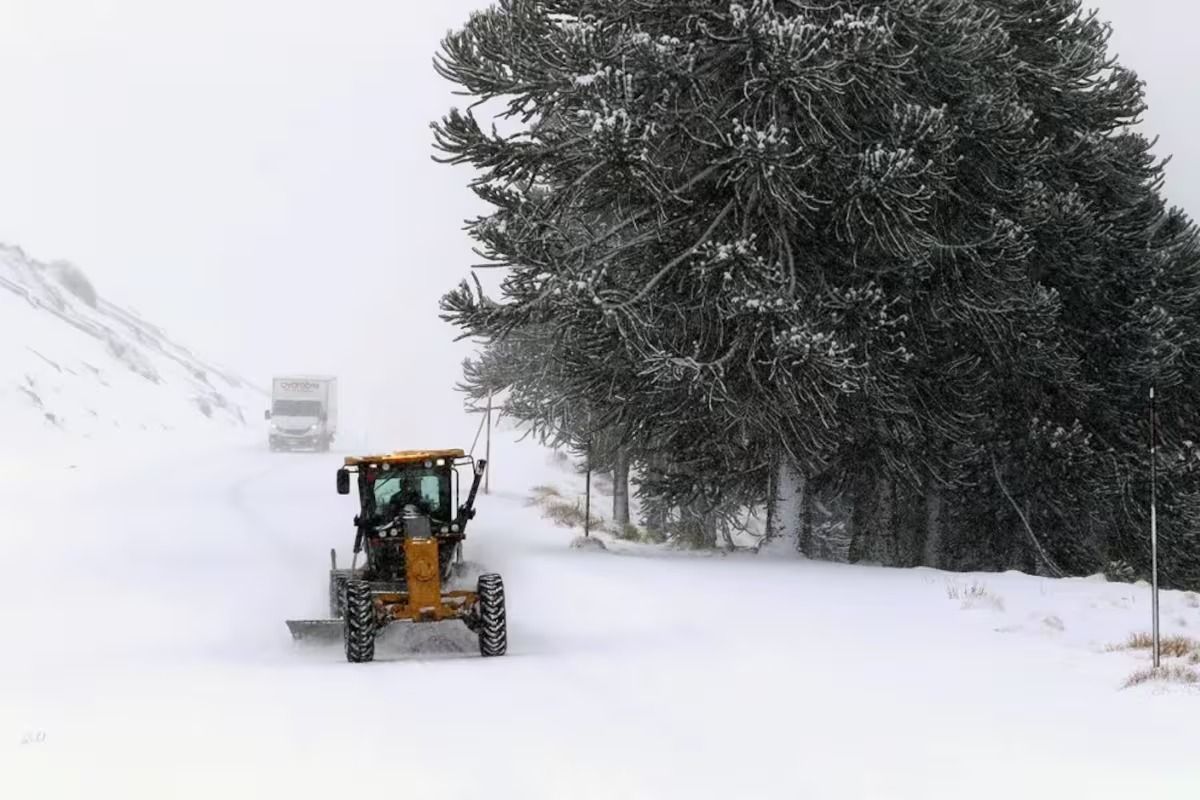
An advancing cold front is bringing persistent rain to the provinces of Santa Cruz and Tierra del Fuego, along with snow in mountain areas, with accumulations that could exceed 15 millimeters in some localities. Wind is another key factor: the SMN forecasts sustained speeds of 40 to 60 kilometers per hour, with gusts at or above 90 kilometers per hour in the far south of the mainland and in the Falklands. Authorities warned that the combination of water and low temperatures will complicate travel on the region's roads.
Between the start and middle of the week, the instability extends toward the Chubut mountain range and parts of Río Negro and Neuquén, where rain and snow are possible even at lower elevations. Across the rest of the country, by contrast, a marked shortage of rainfall prevails.
The most severe episode is now over. At its peak, early in the month, the Antarctic-origin air mass placed Argentina among the coldest spots on the planet outside the polar regions, with lows of down to -14.2 °C in Maquinchao (Río Negro) and unusual snowfall in towns on the outskirts of Buenos Aires. That polar front also carried temperature anomalies into Uruguay, Paraguay and southern Brazil.
Heading into the second half of the week, the arrival of northerly winds is favoring a slow recovery in temperatures in the central belt, with highs that could approach 20 °C. Even so, the relief will be gradual, and early mornings will continue to register readings near or below 0 °C across wide areas of the Pampas region and Cuyo.
The SMN warned that low temperatures may pose a mild to moderate health risk, particularly for the most vulnerable groups such as children and older adults, and advised following official alerts, especially in Patagonia, where winter remains in its most active phase.


Top Comments
Disclaimer & comment rulesCommenting for this story is now closed.
If you have a Facebook account, become a fan and comment on our Facebook Page!