MercoPress. South Atlantic News Agency
No change in sight for downspouts – particularly of the Paraná river
 “For us to have an improvement in the situation, rains would have to be higher than normal,” Borús explained
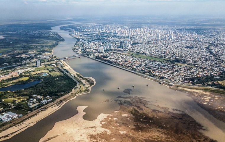
 The Paraná River Tuesday recorded once again a minus 46 centimeters downspout in front of the capital of the Argentine Province of Entre Ríos, thus repeating Aug. 18's all-time low, Argentine Coast Guard (Prefectura Naval) confirmed, as the entire country goes through an unprecedented heatwave.
Argentina's National Water Institute (INA) also said that “a quarter with deficient precipitation conditions is expected on the Argentine coast, while for the regions of the Paraná and Paraguay basin a quarter with normal conditions is expected and for the Uruguay river basin a quarter with deficit conditions is expected.”
Paraná City Council also explained that despite the downspout, water supply to the city was guaranteed.
Local authorities also announced a recovery is not expected in the coming weeks. Hence, the historical downspout that continues to affect hundreds of people continues to deepen.
“A recovery is not expected in the next few weeks. Fluvial levels will continue in the low water band. The climatic trend as of March 31 is unfavorable,“ the Water Institute said in a statement. The river had recovered slightly in December, but 2022 started with a sharp decline, dropping more than half a meter in just days. Since Jan. 4, it has remained below zero.
The Paraná river has thus completed 22 months of water crisis. It was first felt in the Province of Misiones as early as March 2020 and has generated an unprecedented water crisis in all the coastal cities of the La Plata Basin.
In this regard, the of the INA, , reviewed with FIRST EDITION how this phenomenon occurred that caused economic, environmental and social impacts.
“It started with a drought that began to manifest itself in June 2019 in the Paraguay basin and later on the missionary shore we felt it strongly in the first week of March 2020. Since then we have had persistent levels that are very low. This week we had a minimum in Puerto Iguazú of 1.70 / 1.90 meters, an extraordinarily low level and what also matters are the fluctuations in the waterway,” INA's deputy manager of Information Systems and Hydrological Alert Juan Borús said.
The expert also explained the whole situation was due to lack of rains and therefore all it takes for this situation to revert is a change in the meteorological conditions, which is why “all eyes are on the pattern of regional rains in the coming months.”
“Until now, all the forecasts we have in the short, medium and long term that would be throughout the rest of the summer and until the beginning of autumn, indicate that the rains would not be normal, that is, they would be lower than normal, and that obviously is not going to be enough for us to have a noticeable improvement,” Borús admitted. But ”for us to have an improvement in the situation, rains would have to be higher than normal.“
Therefore, ”all the impacts, which we have already seen since March 2020, persist with the same severity.“
He also pointed out that ”electricity generation also has a limitation because the Yacyretá and Salto Grande dams are producing half the energy they should produce.”


Top Comments
Disclaimer & comment rulesCommenting for this story is now closed.
If you have a Facebook account, become a fan and comment on our Facebook Page!